Log in
All resources
Create a design
383 Free Images of Maps Of Ireland
atlas maior, vol 6 (scotland and ireland) - joan blaeu, 1667 - bl 114.h(star).6
copper engraving print
british library
joan blaeu
1667 maps
maps from the earth and its inhabitants, vol. iv
1890s maps of ireland
cartography
1870s maps of the british isles
history
atlas maior, vol 6 (scotland and ireland) - joan blaeu, 1667 - bl 114.h(star).6
1667 maps
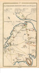
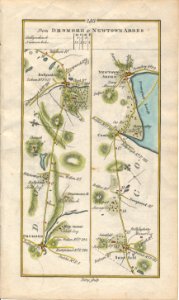
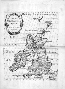
daniel de la feuille
1747 maps
maps from the earth and its inhabitants, vol. iv
linguistic maps of the united kingdom
atlas maior, vol 6 (scotland and ireland) - joan blaeu, 1667 - bl 114.h(star).6
1667 maps
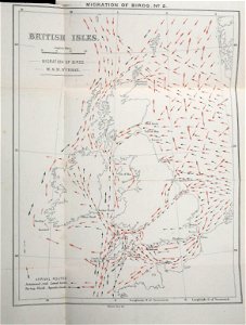
bird
maps
atlas maior, vol 6 (scotland and ireland) - joan blaeu, 1667 - bl 114.h(star).6
1667 maps
atlas maior, vol 6 (scotland and ireland) - joan blaeu, 1667 - bl 114.h(star).6
1667 maps
atlas maior, vol 6 (scotland and ireland) - joan blaeu, 1667 - bl 114.h(star).6
1667 maps
atlas maior, vol 6 (scotland and ireland) - joan blaeu, 1667 - bl 114.h(star).6
1667 maps
atlas maior, vol 6 (scotland and ireland) - joan blaeu, 1667 - bl 114.h(star).6
1667 maps
maps of ireland facing west by gerardus mercator
ateliers bmb mercator
atlas maior, vol 6 (scotland and ireland) - joan blaeu, 1667 - bl 114.h(star).6
1667 maps
atlas maior, vol 6 (scotland and ireland) - joan blaeu, 1667 - bl 114.h(star).6
1667 maps
atlas maior, vol 6 (scotland and ireland) - joan blaeu, 1667 - bl 114.h(star).6
1667 maps
atlas maior, vol 6 (scotland and ireland) - joan blaeu, 1667 - bl 114.h(star).6
1667 maps
atlas maior, vol 6 (scotland and ireland) - joan blaeu, 1667 - bl 114.h(star).6
1667 maps
atlas maior, vol 6 (scotland and ireland) - joan blaeu, 1667 - bl 114.h(star).6
1667 maps
atlas maior, vol 6 (scotland and ireland) - joan blaeu, 1667 - bl 114.h(star).6
1667 maps
atlas maior, vol 6 (scotland and ireland) - joan blaeu, 1667 - bl 114.h(star).6
1667 maps
atlas maior, vol 6 (scotland and ireland) - joan blaeu, 1667 - bl 114.h(star).6
1667 maps
atlas maior, vol 6 (scotland and ireland) - joan blaeu, 1667 - bl 114.h(star).6
1667 maps
atlas maior, vol 6 (scotland and ireland) - joan blaeu, 1667 - bl 114.h(star).6
1667 maps
atlas maior, vol 6 (scotland and ireland) - joan blaeu, 1667 - bl 114.h(star).6
1667 maps
atlas maior, vol 6 (scotland and ireland) - joan blaeu, 1667 - bl 114.h(star).6
1667 maps
atlas maior, vol 6 (scotland and ireland) - joan blaeu, 1667 - bl 114.h(star).6
1667 maps
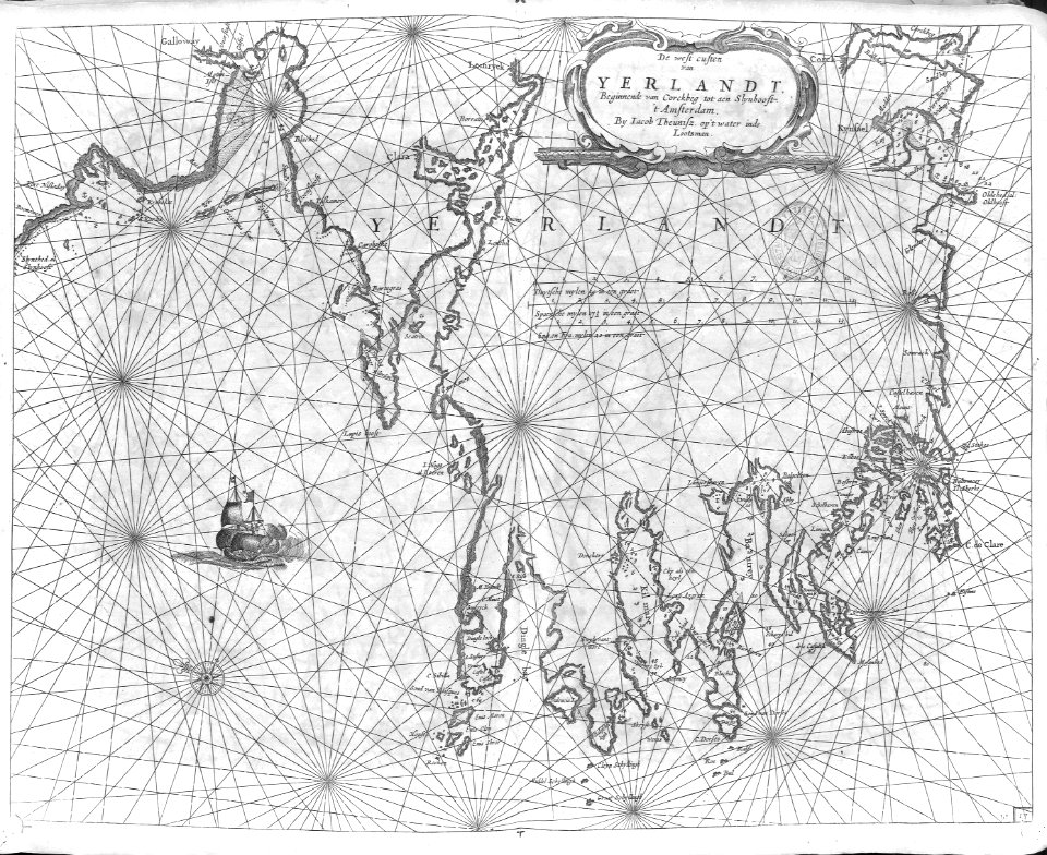
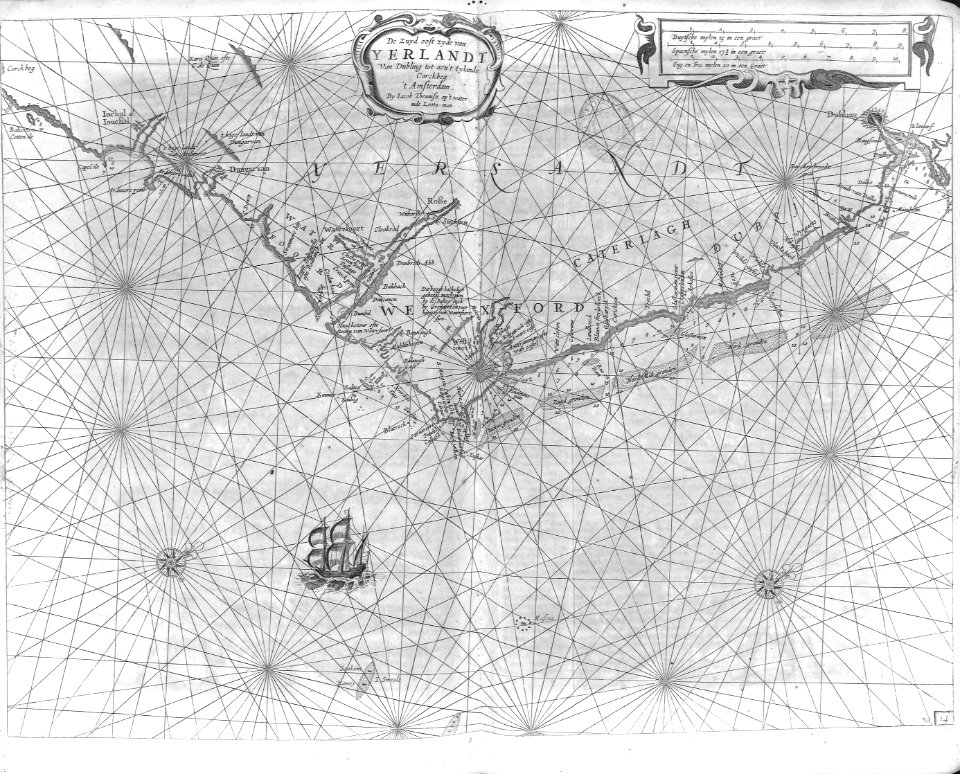
maps of south ireland by gerardus mercator
ateliers bmb mercator
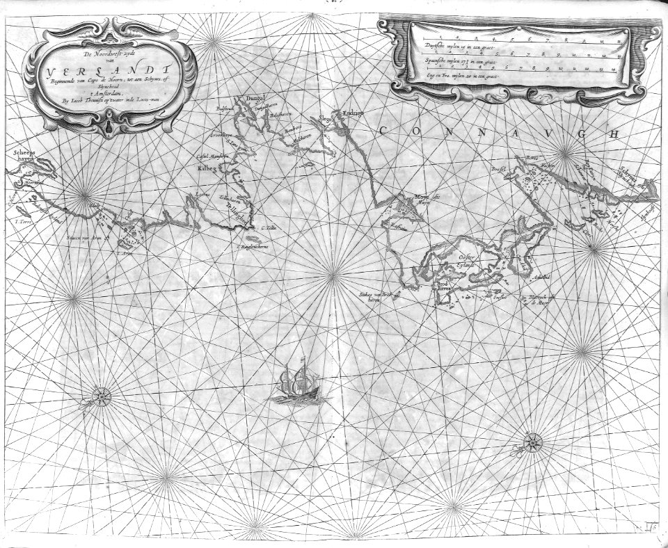
maps of north ireland by gerardus mercator
ateliers bmb mercator
laying the atlantic telegraph cable from ship to shore (1857)
valentia island
admiralty charts region b: england wales ireland english channel southern north sea
admiralty charts 1401-1600
atlas maior, vol 6 (scotland and ireland) - joan blaeu, 1667 - bl 114.h(star).6
1667 maps
atlas maior, vol 6 (scotland and ireland) - joan blaeu, 1667 - bl 114.h(star).6
1667 maps
atlas maior, vol 6 (scotland and ireland) - joan blaeu, 1667 - bl 114.h(star).6
maps of idrone by gerardus mercator
atlas maior, vol 6 (scotland and ireland) - joan blaeu, 1667 - bl 114.h(star).6
1667 maps
maps from the earth and its inhabitants, vol. iv
topographic maps of ireland
atlas maior, vol 6 (scotland and ireland) - joan blaeu, 1667 - bl 114.h(star).6
1667 maps
atlas maior, vol 6 (scotland and ireland) - joan blaeu, 1667 - bl 114.h(star).6
1667 maps
atlas maior, vol 6 (scotland and ireland) - joan blaeu, 1667 - bl 114.h(star).6
1667 maps
old maps of scotland from the norman b. leventhal map center
old maps of ireland from the norman b. leventhal map center
atlas maior, vol 6 (scotland and ireland) - joan blaeu, 1667 - bl 114.h(star).6
1667 maps
atlas maior, vol 6 (scotland and ireland) - joan blaeu, 1667 - bl 114.h(star).6
1667 maps
maps from the earth and its inhabitants, vol. iv
topographic maps of the united kingdom
maps from the earth and its inhabitants, vol. iv
1880s maps of ireland
1890s maps of ireland
bogs in ireland
maps from the earth and its inhabitants, vol. iv
illiteracy in the united kingdom
history
maps
history
maps
a school geography (1898) by bird
cork harbour
1740s maps of ireland
1748 fleurons
russo-turkish war (1877–1878) in art
great eastern crisis (1875–78)
admiralty charts region b: england wales ireland english channel southern north sea
admiralty charts 1001-1200
1690s maps of the caribbean
1690s maps of the americas
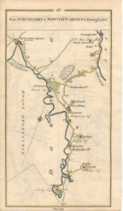
1740s maps of ireland
1749 fleurons
maps from the earth and its inhabitants, vol. iv
1880s maps of ireland
arnold's geographical handbook (1899)
1890s maps of ireland
arnold's geographical handbook (1899)
1890s maps of ireland
arnold's geographical handbook (1899)
1890s maps of ireland
magazine fort, dublin
maps by john rocque
atlas sive cosmographicae (gerardus mercator, 1623)
maps of north ireland by gerardus mercator
atlas sive cosmographicae (gerardus mercator, 1623)
maps of south ireland by gerardus mercator
cartography
maps
history
maps
atlas sive cosmographicae (gerardus mercator, 1623)
maps of ireland facing west by gerardus mercator
cartouche (cartography)
maps by john rocque
encyclopédie méthodique - géographie physique
ambroise tardieu
united kingdom
map
maps from the earth and its inhabitants, vol. iv
1880s maps of ireland
atlas sive cosmographicae (gerardus mercator, 1630)
maps of north ireland by gerardus mercator
atlas sive cosmographicae (gerardus mercator, 1630)
maps of south ireland by gerardus mercator
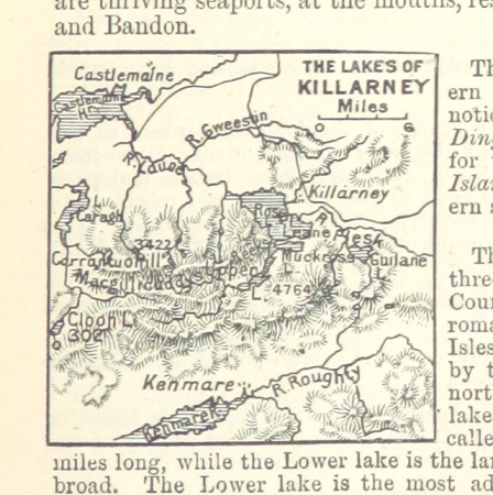
a class-book of modern geography (1898)
maps of county kerry
a system of modern geography (1810)
1810s maps of ireland
atlas sive cosmographicae (gerardus mercator, 1630)
maps of ireland facing west by gerardus mercator
historical
history
cartography
maps
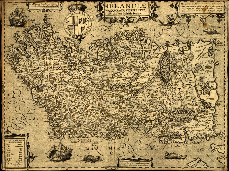
expeditionis hispanorum in angliam vera descriptio anno domini mdlxxxviii
paper
cartography
maps
cartography
maps
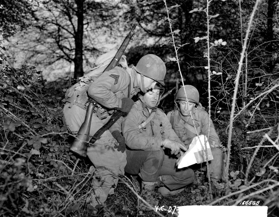
34th infantry division
group portrait
admiralty charts 2001-2200
westport, county mayo
blue coat school, dublin
1906 books
maps of the arctic by gerardus mercator
maps by hendrik hondius the younger
britain & northern ireland
european theater
picturesque views, on the river medway, from the nore to the vicinity of its source in sussex (1793)
maps of the river medway
map of europe by guillaume delisle (1700)
university of washington
301 - 383 of 383
/ 4